Gandiaye
The town and commune of Gandiaye in the Department of Kaolack, central Senegal, lies along National Route 1 about 24 kilometers from Kaolack. The population (2002) is about 10,000 consisting of the Serer, Wolof, Fula, Bambara and Jola) ethnic groups.
The commune includes the rural towns of Thiomby, le Dya, and Ndiebel. The economy is mainly agricultural, marketing to highway traffic. Outsiders come to fish in the Saloum River tributaries.
the Mayor of Gandiaye was Dr. El Hadji Gueye. The area is Muslim, Catholic and adherents to Serer religion. The town has a Muslim and a Catholic cemetery.
* Official web-page of Gandiaye (via the Internet Archive)
Map - Gandiaye
Map


Country - Senegal
 |
 |
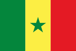
| Flag of Senegal | |
Senegal is notably the westernmost country in the mainland of the Old World, or Afro-Eurasia. It owes its name to the Senegal River, which borders it to the east and north. The climate is typically Sahelian, though there is a rainy season. Senegal covers a land area of almost 197000 km2 and has a population of around million. The state is a unitary presidential republic; since the country's foundation in 1960, it has been recognized as one of the most stable countries on the African continent.
Currency / Language
| ISO | Currency | Symbol | Significant figures |
|---|---|---|---|
| XOF | West African CFA franc | Fr | 0 |
| ISO | Language |
|---|---|
| FR | French language |
| WO | Wolof language |